Population density map is the Netherlands.by @researchremora
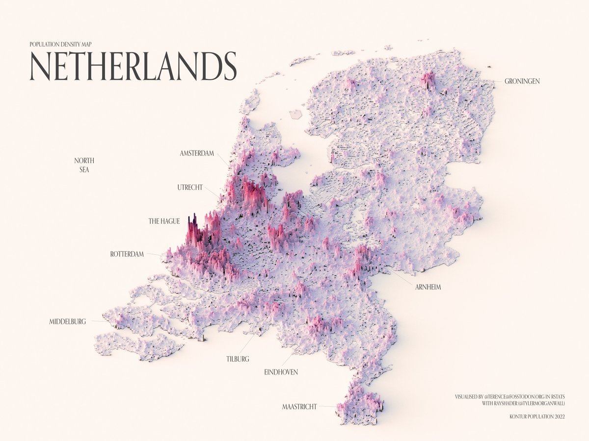
Population density map is the Netherlands. by @researchremora
Population density map is the Netherlands. by @researchremora

Exaggerated topographic map of Falkland Islands. by @verygoodmaps

Map of Europe split by what hand they traditionally wear their weddings rings on.

Map of slopes from 0-15 degrees calculated from the 3D Elevation Program (3DEP) by the US Geological Survey Location: Central Texas. Calculated and exported using QGIS. by u/Physical_Dare_2783
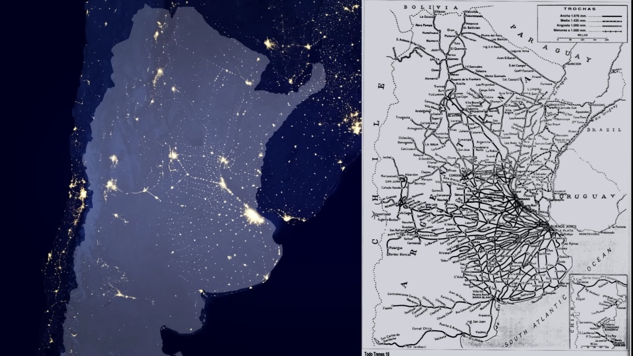
Argentina at night compared to a railroad map from the early 20. century

Population density map of Denmark. by @researchremora

Population density map of Nepal. by @researchremora
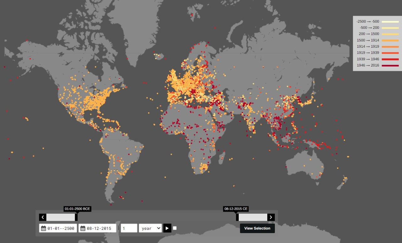
All the documented battles ever fought on Earth. Interactive map: http://battles.nodegoat.net

Contour line map showing the topography of Colombia. by @PythonMaps