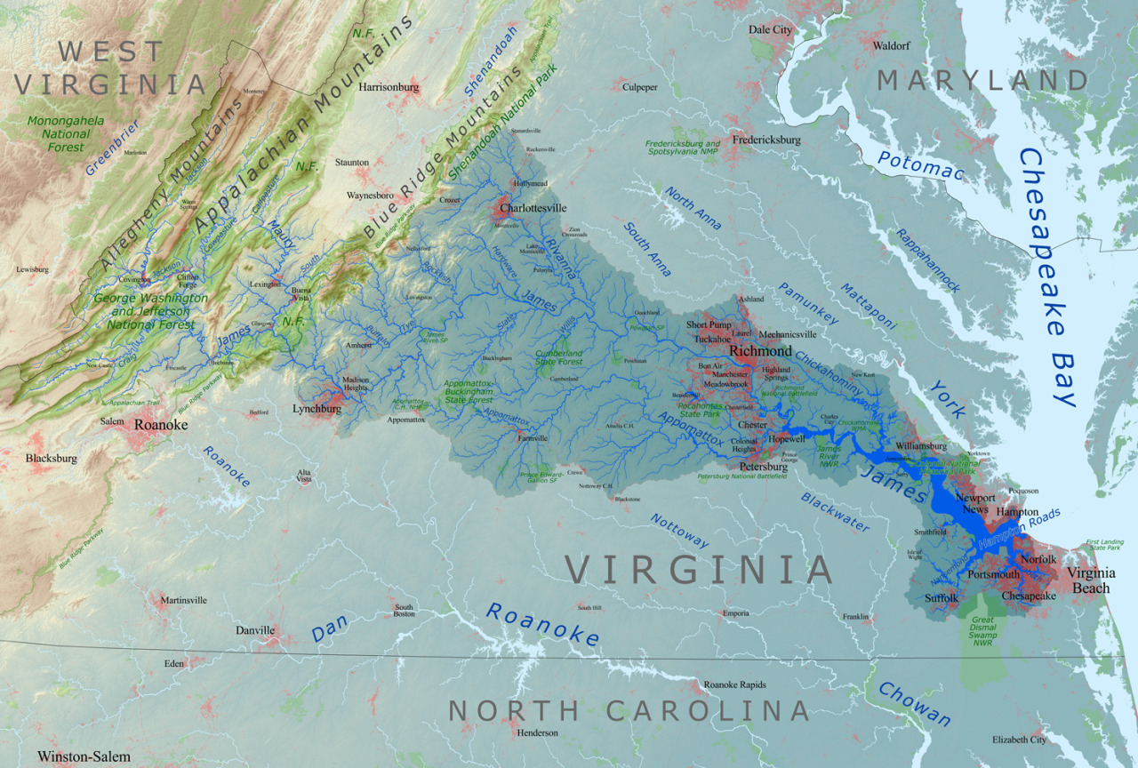
Map of the James River Drainage Basin
Tag Archives: drainage
Countries covered by The Black Sea drainage basin. by…
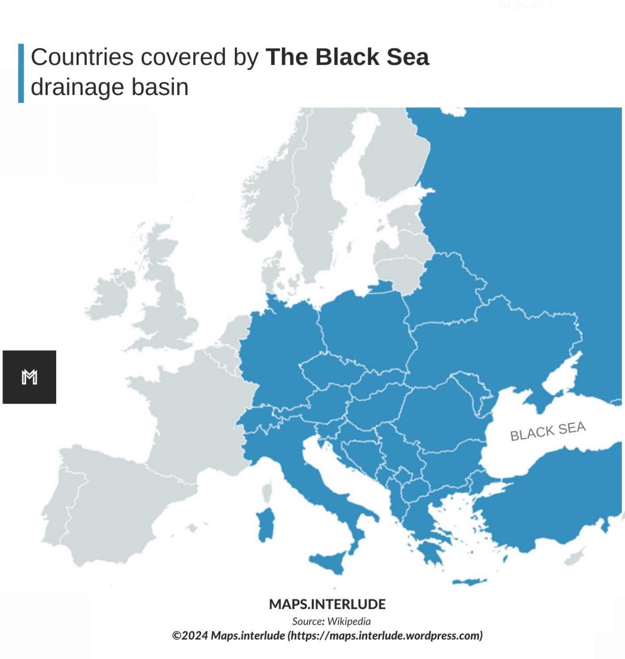
Countries covered by The Black Sea drainage basin. by maps.interlude
The Black Sea drainage basin

The Black Sea drainage basin
Ocean drainage basin map of Asiaby u/Fejetlenfej

Ocean drainage basin map of Asia by u/Fejetlenfej
Ocean drainage basin map of the United Statesby u/Fejetlenfej

Ocean drainage basin map of the United States by u/Fejetlenfej
Ocean drainage basin map of the worldby u/Fejetlenfej

Ocean drainage basin map of the world by u/Fejetlenfej
Ocean drainage basin map of the worldby u/Fejetlenfej
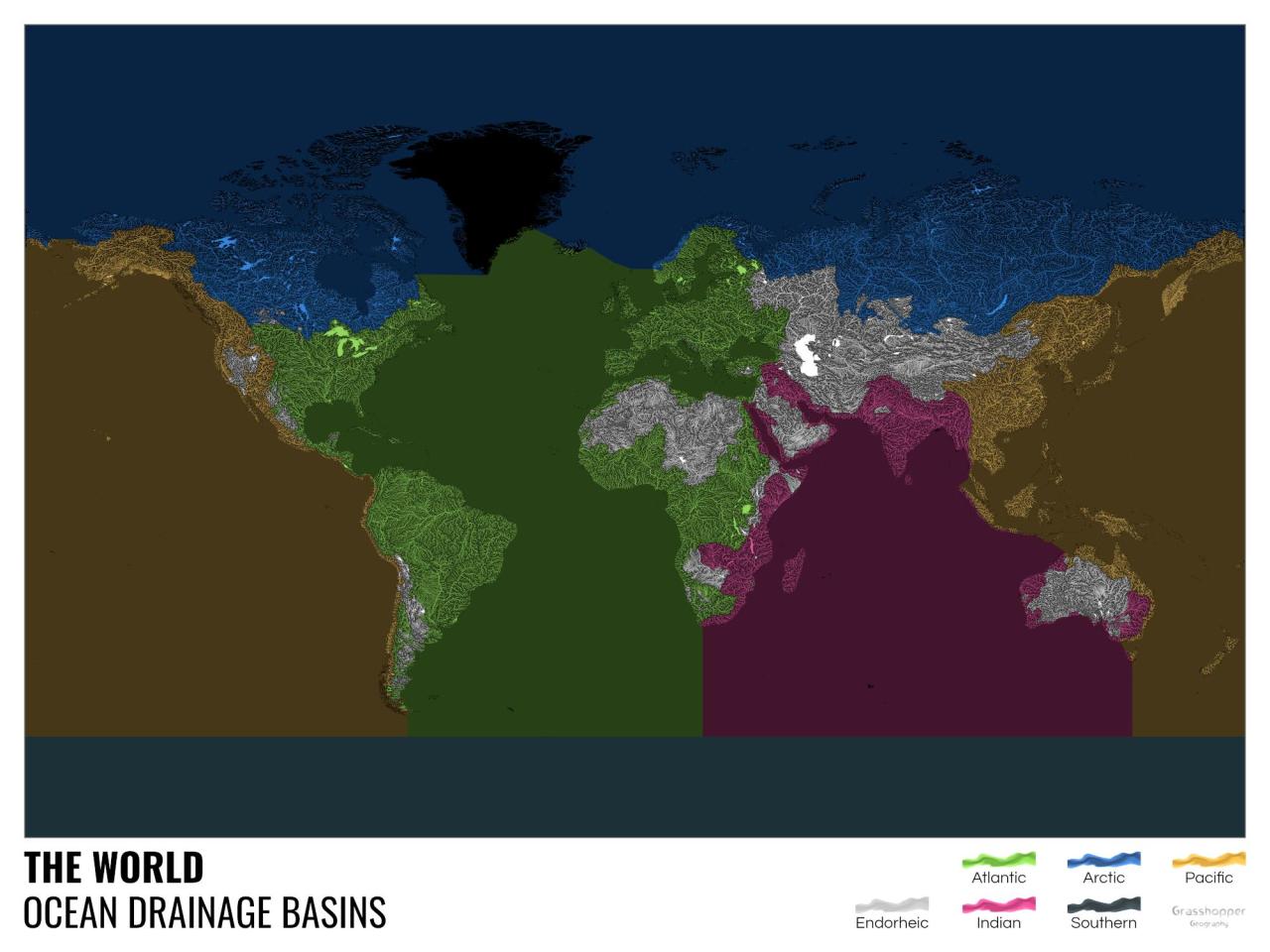
Ocean drainage basin map of the world by u/Fejetlenfej
Map of the Amazon River drainage basin.

Map of the Amazon River drainage basin.
Great Lakes Watersheds The map color codes every drainage basin…

Great Lakes Watersheds The map color codes every drainage basin (watershed). A watershed can be as small as a few acres draining into a farm pond or as large as several thousand square miles for a major lake, such as one of our Great Lakes. For example, on this map, all the different watersheds for …
Continue reading “Great Lakes Watersheds
The map color codes every drainage basin…”
The Baltic Sea drainage basin. Land cover and population…

The Baltic Sea drainage basin. Land cover and population density. The Baltic Sea drainage basin with land cover (left) and population distribution (right). Dark green: forests; light green: open and agricultural spaces; different shades of orange: population density. Red lines designate drainage sub-basins. Figures are by Hugo Ahlenius, GRID-Arendal Baltic Environmental Atlas.
North America Drainage Basins

North America Drainage Basins
Lake Sevan’s drainage area & bathymetry.by @sidapo_cartisan
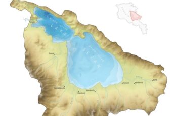
Lake Sevan’s drainage area & bathymetry. by @sidapo_cartisan