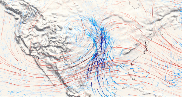

Severe weather pattern: upper-levels winds (red) and low-level moisture transport (blue) for 18 UTC, 13 Dec 2022.
data source: GFS, from NOMADS server; visualization: ParaView
data link: https://nomads.ncep.noaa.gov/dods/gfs_0p25
The
animation shows moisture transport as blue streamlines and wind as red
streamlines. The darker blues represent higher values of moisture
transport, which is occurring near the surface and the darker reds
represent higher wind speeds, which are occurring at the jet level
(roughly 12 km).
This is a classic pattern for severe weather:
https://www.cnn.com/2022/11/28/weather/us-leads-tornado-numbers-tornado-alley-xpn/index.html
There is also the potential for severe weather in the Gulf again today. Please refer to the NWS for guidance: weather.gov
Mathew Barlow
Professor of Climate Science
University of Massachusetts Lowell