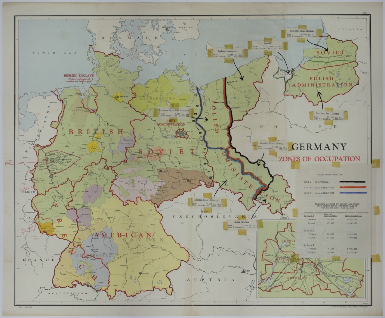

Map of Proposed Boundaries of Germany after WW2, including the actual border changes and occupation zone borders.
An American map titled “Germany: Zones of Occupation.” The map shows
American, British, French, and Soviet occupation zones, including joint
administration areas such as the Bremen Enclave and Berlin. An attached
sheet, hiding portions of the map and the legend, refer to the
“Polish-German Frontier” and details border proposals east of the
Oder-Neisse Line, the area covered by each proposal, and the populations
within as of 1939. Annotations, in red pencil, highlight the Ruhr and
Saar areas with an additional line indicating a proposed railroad line
near Aachen, Germany.