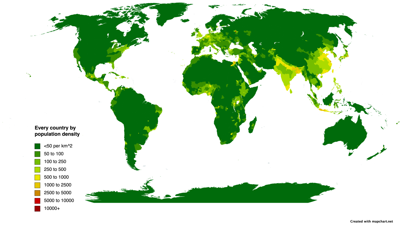

A map of the population density of every regional subdivision.
I
used Mapchart’s new subdivision feature, and mapped the population
density of the first subdivision of every country. For some of the small
ones, like Eswatini, Slovenia, and Luxembourg, I just used their
overall population density, and for some with very tiny states, like
Vietnam, I used their regional population density instead.Some
of them, like Nigeria, didn’t have population density statistics at
all, so I calculated them state by state instead. I feel bad about
Morocco. I was going to do the same for them, but there was almost no
information on the subdivisions, so I just had to go with overall
density in the end.Otherwise, I’m
pretty happy with this map! You can see how much denser East Asia,
South Asia, Northwest Europe, Java, the Mexican, Ethiopian, and
Victorian Plateaus, and West Africa are than the rest of the world.