
Countries and States that have or had ‘United States’ in their name. by u/Aofen
Category Archives: Maps
The word for ‘pear’ in European languages. Many…

The word for ‘pear’ in European languages. Many languages – well at least Norwegian and German – use the same word for light bulb. by @Oysteib
More than 40% of residents of North and South Dakota live east…
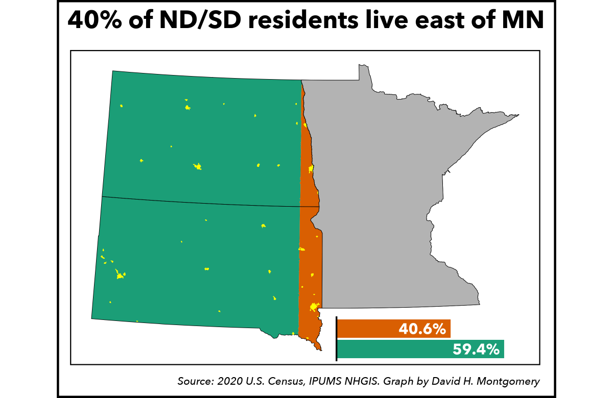
More than 40% of residents of North and South Dakota live east of Minnesota (’s westernmost point). Hat tip to u/Llcmn on Reddit for the initial insight. by @dhmontgomery
Contour line map of Iraq.by @PythonMaps

Contour line map of Iraq. by @PythonMaps
The Turgot map of Paris, a highly accurate and detailed map of…

The Turgot map of Paris, a highly accurate and detailed map of the city as it existed in the 1730s
Map of the most polluted cities/towns in the US. Air quality is…
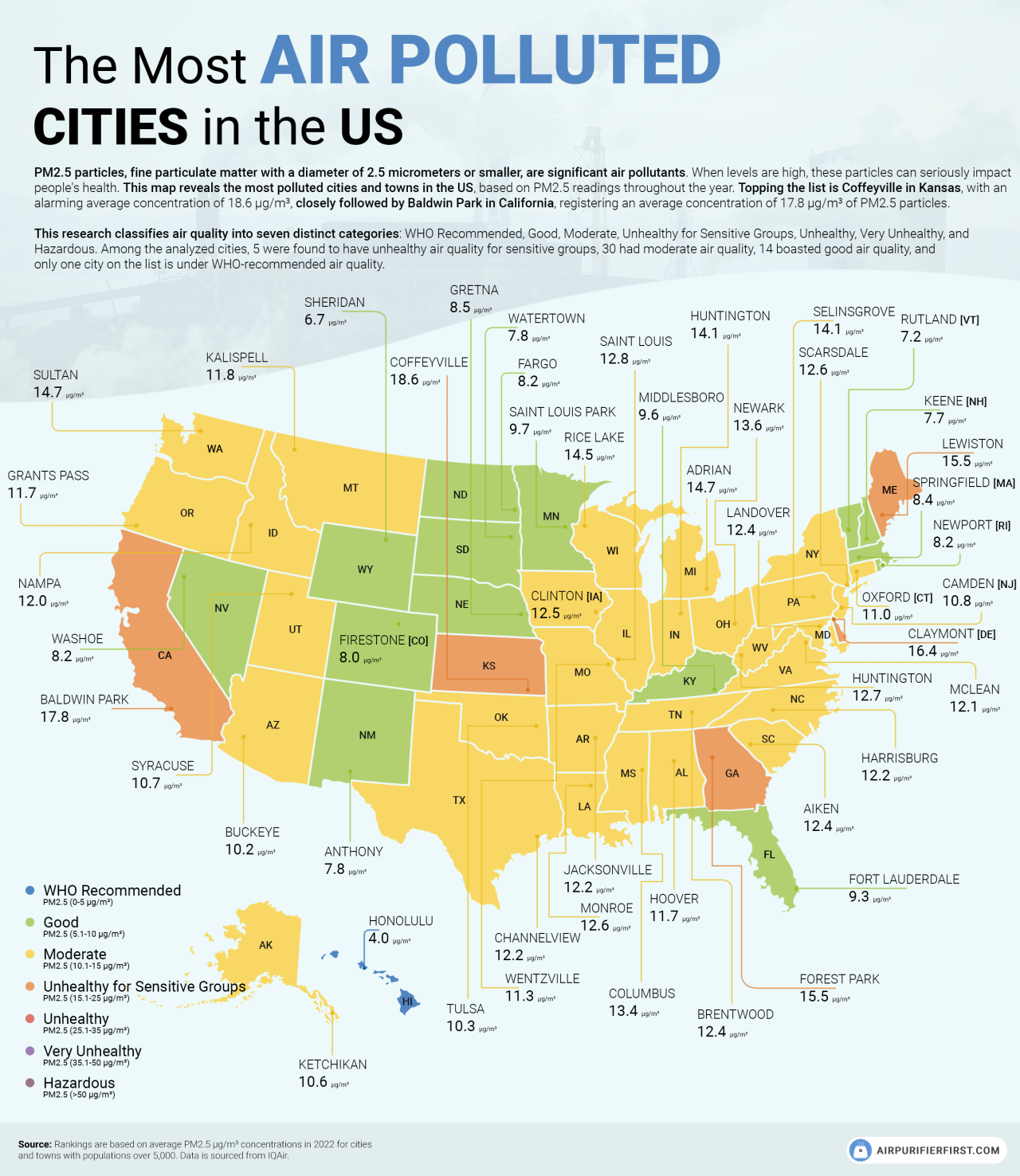
Map of the most polluted cities/towns in the US. Air quality is a huge concern, as more than 30 of the most polluted cities in the US have moderate air quality.
The Balkans in 1355 AD

The Balkans in 1355 AD
“A wife must obey her husband”– percent who…

“A wife must obey her husband”– percent who agree with that statement in Latin America.
European Electricity Mix by Countryby u/NoComplaint1281
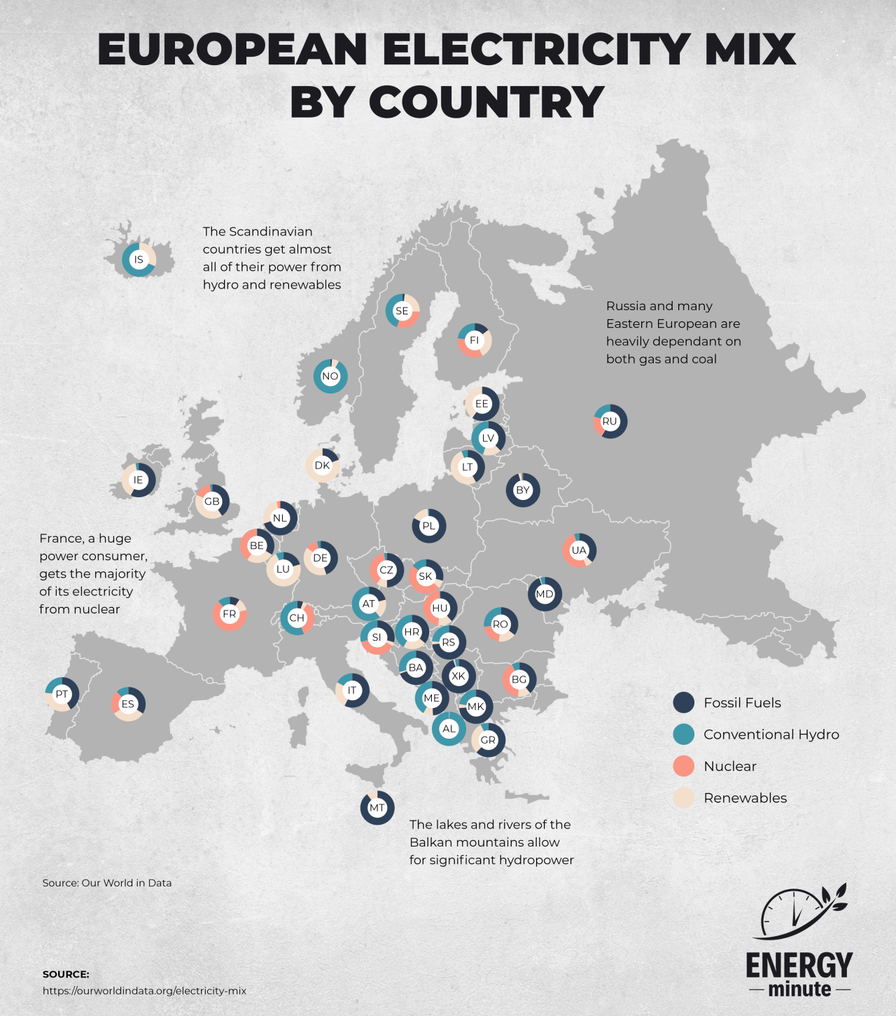
European Electricity Mix by Country by u/NoComplaint1281
South African Police Stations By Language
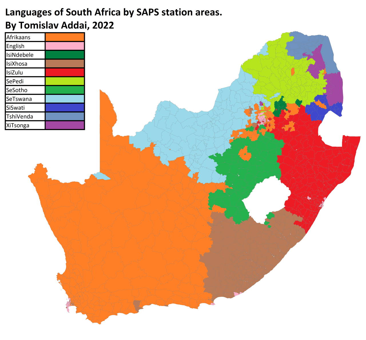
South African Police Stations By Language
The Most Dangerous Time to Drive in Each State Driving is…

The Most Dangerous Time to Drive in Each State Driving is inherently dangerous. But your chances of being in an accident are greater if you drive at certain times of the day, week, and year – and these factors, in turn, differ from state to state. Using data from the National Highway Traffic Safety Administration, …
Continue reading “The Most Dangerous Time to Drive in Each State
Driving is…”
Different countries’ usage of…
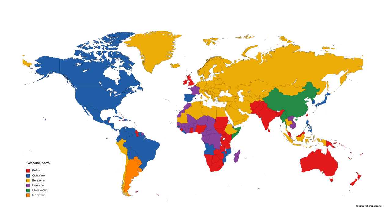
Different countries’ usage of gasoline/petrol/essence/benzene based on their native languages. Now the gasoline/petrol debate can rest.