
Central Europe in the 10th and 11th centuries. by LegendesCarto
Category Archives: Maps
Carpathian Ukraine. 30 December 1938 – 15 March (May) 1939.by…
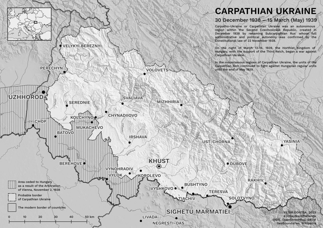
Carpathian Ukraine. 30 December 1938 – 15 March (May) 1939. by gontsa
Average age of of young people leaving home in European…
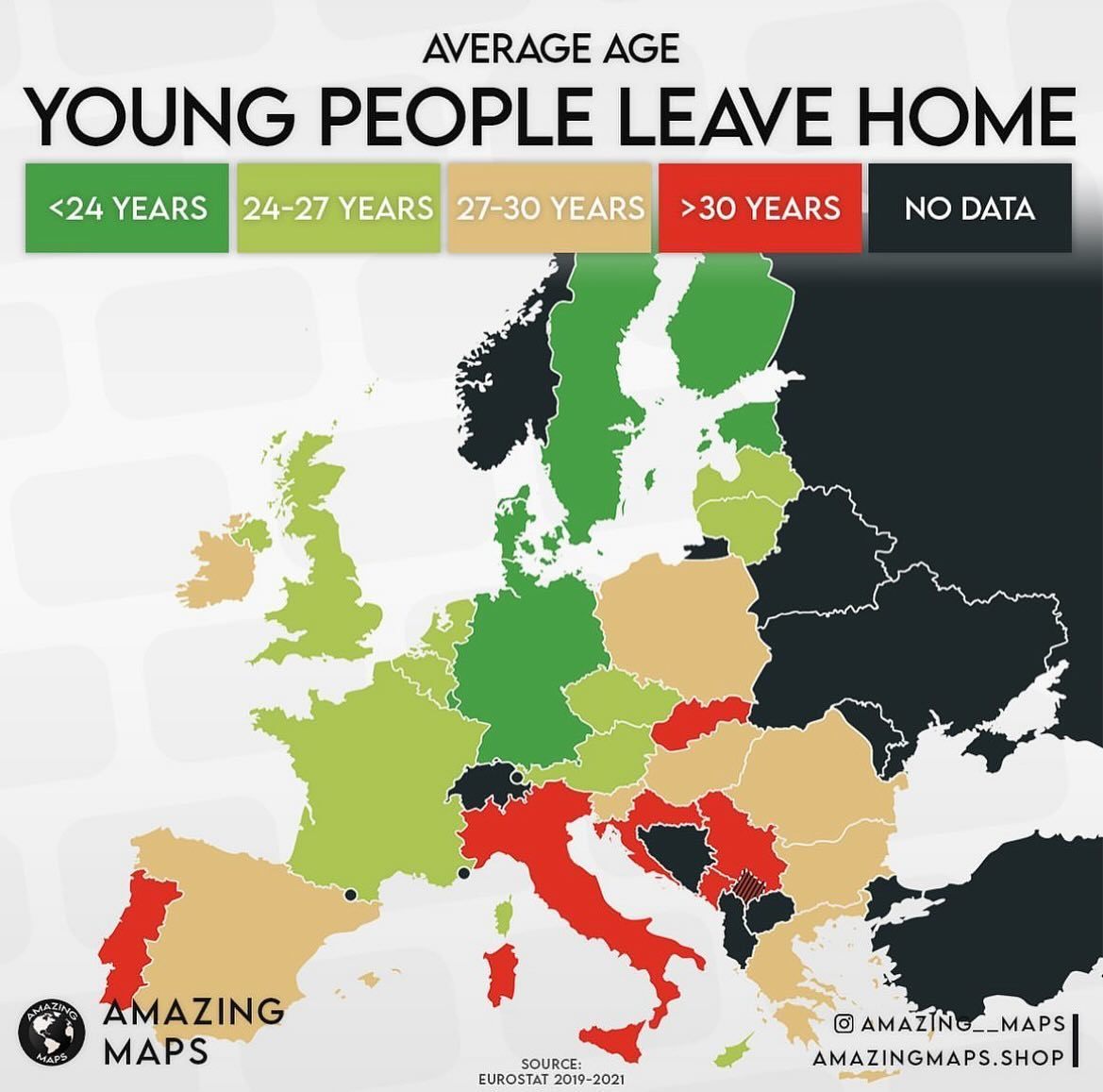
Average age of of young people leaving home in European countries 🇪🇺. by amazing__maps
Fonts used in US state’s official tourism board logos.by…

Fonts used in US state’s official tourism board logos. by atlasova.world
If the United States broke apart like the Soviet…
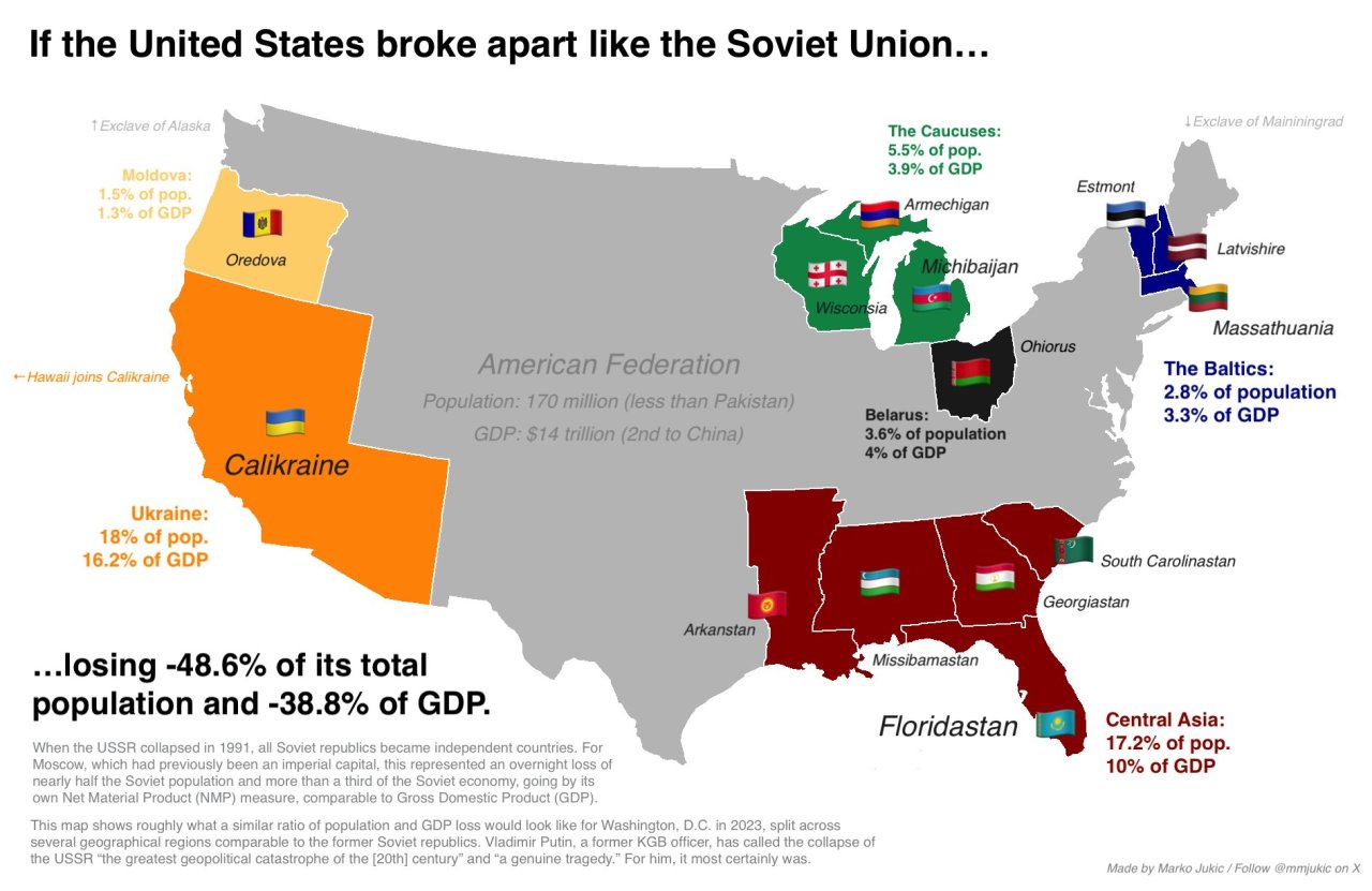
If the United States broke apart like the Soviet Union… When the USSR fell, Moscow’s empire instantly lost -48.6% of its population -38.8% of GDP. For comparison, this is how it would look if the U.S. broke apart with the same ratios today. by mmjukic
Sheep population of the World.Number of sheep per person.by…

Sheep population of the World. Number of sheep per person. by _penguin_runner
December is the snowiest month of the year for locations in dark…

December is the snowiest month of the year for locations in dark pink. by Climatologist49
Political parties currently in power in Indian states.
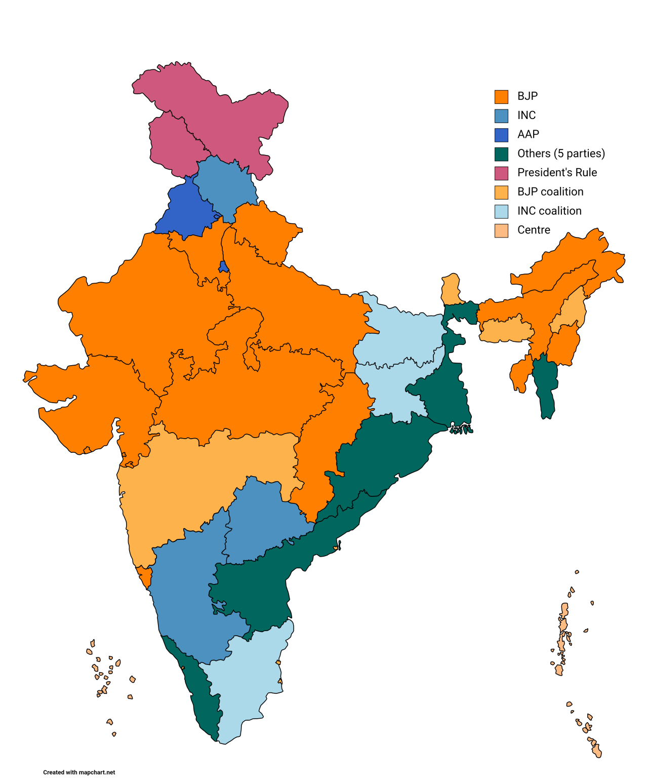
Political parties currently in power in Indian states.
Percentage of croplands in Europe, 2022.by milos_agathon

Percentage of croplands in Europe, 2022. by milos_agathon
Total GDP and Percapita GDP of European entities, 1700.by…

Total GDP and Percapita GDP of European entities, 1700. by Al_Stoyanov
Shaded relief map of Cuba.by verygoodmaps

Shaded relief map of Cuba. by verygoodmaps
The “German belt”
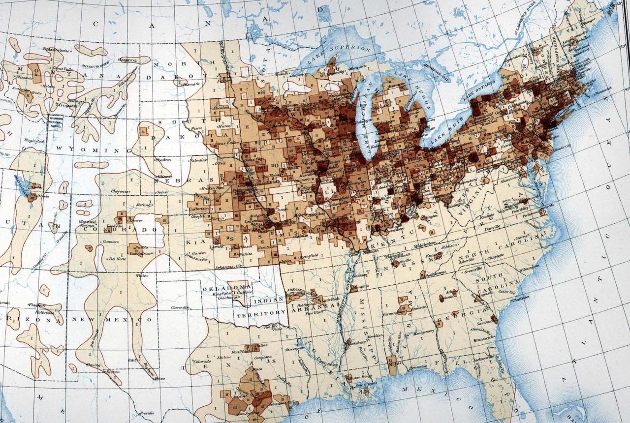
The “German belt”